
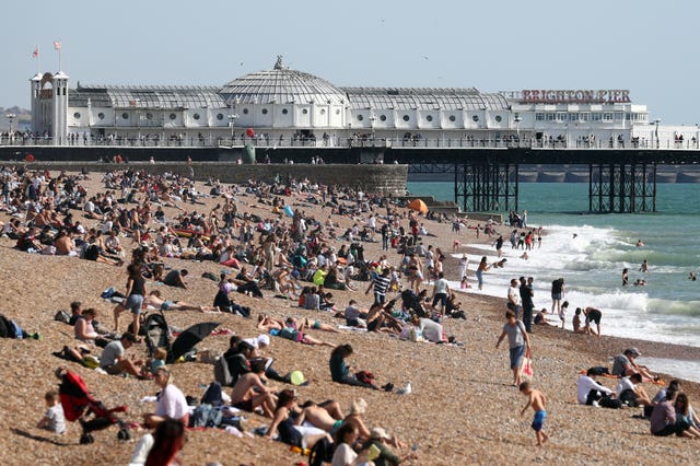
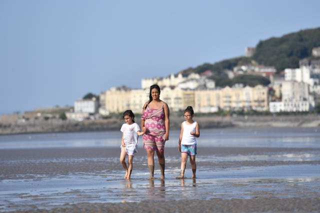
The UK has enjoyed some of the last rays of summer sun before the remains of hurricane Humberto arrive, bringing wet and windy weather.
Much of the country enjoyed unusual levels of sunshine and warm temperatures on Saturday in what is likely to be the last day of summery weather for some before rain arrives.
A top temperature of 27.4C was recorded in the village of Valley, in Anglesey, north Wales, the Met Office said.
The highest recorded temperature last September was 26.5C (80F) at Cambridge Botanic Gardens.
The warmest September day on record was 35.6C (96F), which was recorded at Bawtry in South Yorkshire on September 2 1906.
Meteorologist Becky Mitchell said: “At this time in September it averages 17 or 18 in the south and about 14 in the north.”

However, the warm weather is set to come to an abrupt end on Saturday night as the remains of hurricane Humberto hits the western side of Britain.
Ms Mitchell said that the last of the category three storm has left Bermuda and is travelling across the Atlantic towards the UK.
Much of the tropical weather system has dissipated but it is still likely to bring an area of low pressure that will see an end to the current pleasant conditions.
“We have got some heavy rainfall coming, mainly in the west. It will come in from Northern Ireland, Wales and western parts of England,” Ms Mitchell said.
“The rain is set to come in tonight and it will be quite cloudy and wet from tonight into tomorrow, where we will start to see that heavy rain arrive.”
A yellow severe weather warning for rain is in place for Northern Ireland until 9pm on Sunday.
A second yellow warning for rain is in place from 12.15am on Sunday until 8pm for much of the west of England, the Midlands and Wales, from Carlisle in the north to Worthing in the South East.

Ms Mitchell said: “We have got a low pressure system coming from the Atlantic from tomorrow that will drive the rain in from the west.
“Into next week it’s going to be quite unsettled. Some of these weather systems are the remnants of hurricane Humberto.”
The meteorologist said that the warm air from the continent that caused Saturday’s sunny weather is likely cause more rain as these two weather systems collide.
“It means it’s quite a moist atmosphere, which often brings some heavier rain. The outlook into the start of October does look to stay largely changeable.”


Comments: Our rules
We want our comments to be a lively and valuable part of our community - a place where readers can debate and engage with the most important local issues. The ability to comment on our stories is a privilege, not a right, however, and that privilege may be withdrawn if it is abused or misused.
Please report any comments that break our rules.
Read the rules here